 EMODnet Product Catalogue
Geographical grid systems
Type of resources
Available actions
Topics
Keywords
Contact for the resource
Provided by
Years
Formats
Representation types
Update frequencies
Resolution
-
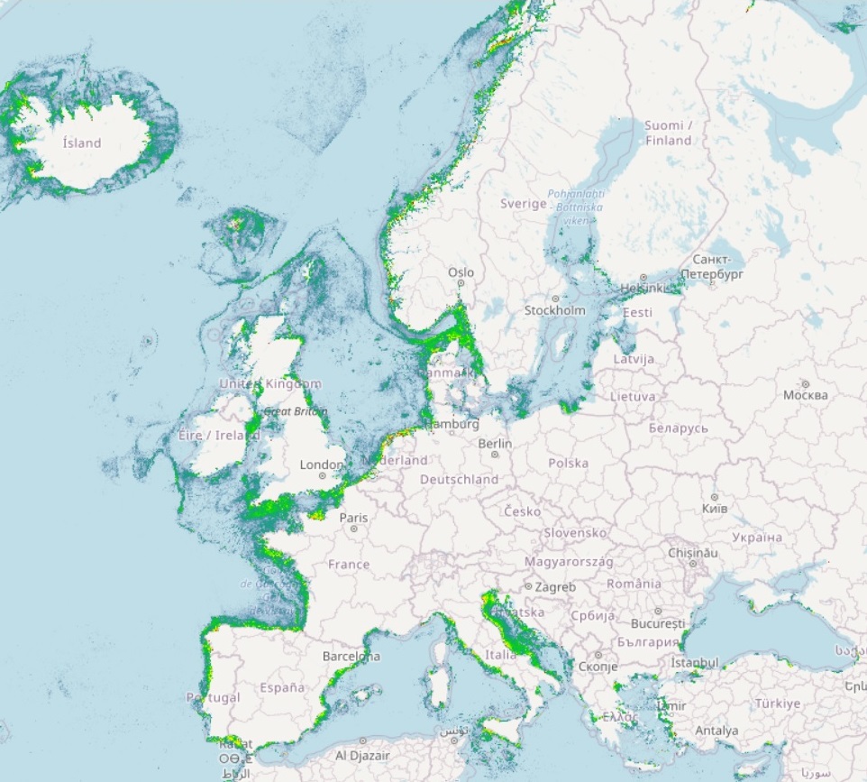
The Route Density Map at 1 km resolution was created by EMSA in 2019 and made available on EMODnet Human Activities, an initiative funded by the EU Commission.
-
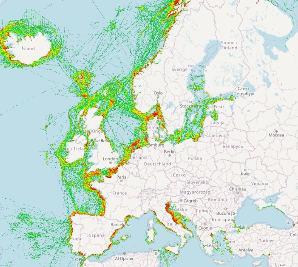
The Vessel Density maps in the EU are created since the 2019 by Cogea for the European Marine Observation and Data Network (EMODnet). The dataset is updated every year and is available for viewing and download on EMODnet web portal (Human Activities, https://emodnet.ec.europa.eu/en/human-activities). The maps are based on AIS data yearly purchased from Collecte Localisation Satellites (CLS) and ORBCOMM. The maps, GeoTIFF format, show shipping density in 1x1km cells of a grid covering all EU waters and some neighbouring areas. Density is expressed as hours per square kilometre per month. The following ship types are available:0 Other, 1 Fishing, 2 Service, 3 Dredging or underwater ops, 4 Sailing, 5 Pleasure Craft, 6 High speed craft, 7 Tug and towing, 8 Passenger, 9 Cargo, 10 Tanker, 11 Military and Law Enforcement, 12 Unknown and All ship types. Data are available by month of year. Yearly averages are also available.
-
This dataset shows the general distribution of Hake spawning grounds in Irish coastal waters, including the Celtic Sea and Irish Sea. Marine nursery areas are habitats that promote the survival of young commercially important fish species.
-
This dataset shows the general distribution of Haddock nursery grounds in Irish coastal waters, including the Celtic Sea and Irish Sea. Marine nursery areas are habitats that promote the survival of young commercially important fish species.
-
This dataset shows the general distribution of Hake nursery grounds in Irish coastal waters, including the Celtic Sea and Irish Sea. Marine nursery areas are habitats that promote the survival of young commercially important fish species.
-
This dataset shows the general distribution of Whiting spawning grounds in Irish coastal waters, including the Celtic Sea and Irish Sea. Marine nursery areas are habitats that promote the survival of young commercially important fish species.
-
This dataset shows the general distribution of Herring spawning grounds in Irish coastal waters. Marine nursery areas are habitats that promote the survival of young commercially important fish species.
-
This dataset shows the general distribution of Herring nursery grounds in Irish coastal waters. Marine nursery areas are habitats that promote the survival of young commercially important fish species.
-
This dataset shows the general distribution of Megrim spawning grounds in Irish coastal waters, including the Celtic Sea and Irish Sea. Marine nursery areas are habitats that promote the survival of young commercially important fish species.
-
This dataset shows the general distribution of Megrim nursery grounds in Irish coastal waters, including the Celtic Sea and Irish Sea. Marine nursery areas are habitats that promote the survival of young commercially important fish species.